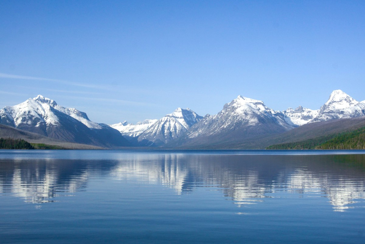
North Fork Flathead: Glacier National Park Border
A 14-mile Wild and Scenic paddle along Glacier National Park's western boundary through pristine grizzly bear wilderness.
At a Glance
Distance
14 miles
Estimated Time
5-7 hours
Difficulty
Intermediate
Route Type
One-Way
Water Body
North Fork Flathead River
Activities
Best Seasons
Route Map
About This Route
The North Fork Flathead River forms the western boundary of Glacier National Park, flowing through one of the most pristine wilderness corridors in the lower 48. The water is glacier-fed, clear, and cold, with views of the park's peaks rising to the east.
This section is designated Wild and Scenic, with no development along either bank. The river flows through old-growth cedar and larch forest, past grizzly bear habitat, and beneath bald eagle nesting territories. The current is moderate with occasional Class I-II riffles.
The North Fork Flathead is one of the cleanest monitored rivers in North America. On clear days, you can see 15+ feet to the bottom through blue-green water.
Highlights
- •Wild and Scenic River designation
- •Glacier National Park boundary
- •One of North America's cleanest rivers
- •Grizzly bear and bald eagle habitat
Safety & Hazards
GRIZZLY BEAR COUNTRY — carry bear spray, make noise, store food in bear canisters. Cold water (45-55°F) — cold water gear recommended. Logging trucks on North Fork Road.
Shuttle Information
Drop vehicle at Blankenship Bridge, then drive north on North Fork Road to Big Creek access (~25 min). Road is unpaved and rough.
Frequently Asked Questions
- How difficult is North Fork Flathead: Glacier National Park Border?
- North Fork Flathead: Glacier National Park Border is rated intermediate difficulty. GRIZZLY BEAR COUNTRY — carry bear spray, make noise, store food in bear canisters. Cold water (45-55°F) — cold water gear recommended. Logging trucks on North Fork Road.
- How long does North Fork Flathead: Glacier National Park Border take?
- North Fork Flathead: Glacier National Park Border covers 14 miles and typically takes 5-7 hours.
- Do I need a shuttle for North Fork Flathead: Glacier National Park Border?
- North Fork Flathead: Glacier National Park Border is a one-way route. Drop vehicle at Blankenship Bridge, then drive north on North Fork Road to Big Creek access (~25 min). Road is unpaved and rough.
- When is the best time to paddle North Fork Flathead: Glacier National Park Border?
- The best seasons for North Fork Flathead: Glacier National Park Border are summer. North Fork Flathead: Glacier National Park Border is on North Fork Flathead River.
- What activities are available on North Fork Flathead: Glacier National Park Border?
- North Fork Flathead: Glacier National Park Border supports Kayaking, Canoeing. Highlights: Wild and Scenic River designation, Glacier National Park boundary, One of North America's cleanest rivers, Grizzly bear and bald eagle habitat.
Quick Facts
- Put-in
- Big Creek Access
- Take-out
- Blankenship Bridge
- Water Body
- North Fork Flathead River
- State
- Montana
Best Paddling in Montana
Read our complete guide →
Paddler Reviews
Share your experience
Sign in to review North Fork Flathead: Glacier National Park Border