Activity
Conditions
Amenities
Shutes Branch (East)
Shutes Branch (East) is a public boat ramp on Cumberland River - Old Hickory Lake near Old Hickory, Tennessee. This beginner-level spot offers kayaking, canoeing, paddleboarding. Amenities include boat ramp, parking, restrooms. Best visited in spring and summer and fall.
At a Glance
Water Body
Lake
Launch Type
Boat Ramp
Difficulty
Beginner
Fee
Free
Activities
Kayaking, Canoeing, SUP, Kayak Fishing
Parking
Parking lot available at boat ramp facility
Cell Service
Good
Calm, flat water suitable for first-time paddlers. No significant current or wave hazards expected.
About This Location
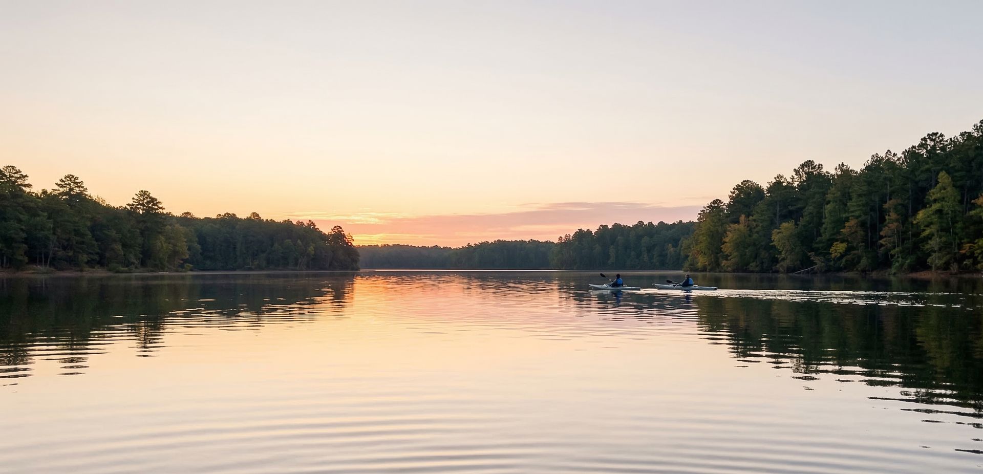
Lake access at Shutes Branch (East) near Old Hickory, Tennessee. Good for kayaking and canoeing.
Situated on Cumberland River - Old Hickory Lake in Tennessee, Shutes Branch (East) is a launch point for kayakers, canoeists, and SUP enthusiasts.
Kayaking is the most popular activity here, with the water conditions supporting a range of skill levels. Canoeists can enjoy the calmer sections for a relaxed paddle. The Southeast's warm climate and diverse waterways support paddling across most of the year.
Expect calm and sheltered conditions on the water. The best time to visit is March through November. Facilities include boat ramp and parking and restrooms and dock and fishing pier and kayak launch and ada accessible and concessions.
Shutes Branch (East) sits about 5 min from Old Hickory, making it a convenient option for local and visiting paddlers.
New to paddling? This is a great beginner spot.
Calm lake waters make Shutes Branch (East) ideal for first-timers. Make sure you have the right gear:
Paddling Tips
- •If fishing, try the coves and points where fish tend to congregate.
- •Morning hours offer the calmest water and best wildlife viewing on the lake.
- •Keep an eye on the weather — afternoon winds can pick up quickly on open water.
- •Hug the shoreline for the most interesting scenery and easier paddling.
Frequently Asked Questions
- How do I access Shutes Branch (East)?
- Shutes Branch (East) is a public boat ramp in Tennessee. There is no entrance fee.
- What activities are available at Shutes Branch (East)?
- Shutes Branch (East) supports kayaking, canoeing, stand up paddleboarding, kayak fishing. The difficulty level is rated beginner, making it great for all skill levels.
- What amenities are at Shutes Branch (East)?
- On-site amenities include boat ramp, parking, restrooms, dock, fishing pier, kayak launch, ada accessible, concessions. Parking: Parking lot available at boat ramp facility.
- When is the best time to visit Shutes Branch (East)?
- The best time to paddle at Shutes Branch (East) is during spring and summer and fall. March through November
- What are the water conditions at Shutes Branch (East)?
- Water conditions at Shutes Branch (East) include calm, sheltered.
- Is Shutes Branch (East) good for beginners?
- Yes, Shutes Branch (East) is rated beginner difficulty, making it an excellent choice for first-time paddlers and families. Calm, flat water suitable for first-time paddlers. No significant current or wave hazards expected.
Location data: USGS ScienceBase · Water conditions: USGS NWIS · Weather: National Weather Service · Coordinates: 36.2499, -86.5680
Quick Facts
- State
- Tennessee
- Region
- Southeast
- Getting There
- ~5 min from Old Hickory
36.2499, -86.5680
Best Paddling in Tennessee
Read our complete guide →
Paddler Reviews
Write a Review
Trip Reports
Paddle Routes from Here
No paddle routes from this location yet.
Be the first to create one!
More Paddling on Old Hickory Lake
6 other launches on this water body
Shutes Branch (West)
Tennessee · 0.2 mi

Harbor Island Yacht Club
Tennessee · 0.3 mi

Sanders Ferry Park
Tennessee · 2.0 mi

Stark Knob
Tennessee · 2.2 mi

Walton's Ferry
Tennessee · 3.4 mi

Cedar Creek Marina
Tennessee · 3.6 mi
Nearby Paddling
Shutes Branch (West)
Tennessee · 0.2 mi
Harbor Island Yacht Club
Tennessee · 0.3 mi
Sanders Ferry Park
Tennessee · 2.0 mi
Stark Knob
Tennessee · 2.2 mi
Walton's Ferry
Tennessee · 3.4 mi
Mallard Point Park
Tennessee · 3.6 mi