Activity
Conditions
Amenities
Shadding Reach
Shadding Reach is a public bank access on Chester River Maryland. This beginner-level spot offers kayaking, canoeing. Amenities include parking, dock. Best visited in spring and summer and fall.
At a Glance
Water Body
River
Launch Type
Bank Access
Difficulty
Beginner
Fee
Fee required
Hours
5 am to 10 pm
Activities
Kayaking, Canoeing
Parking
3 trailer, 3 car spaces
About This Location
Public launch on Chester River in Maryland. Beginner-friendly river paddling.
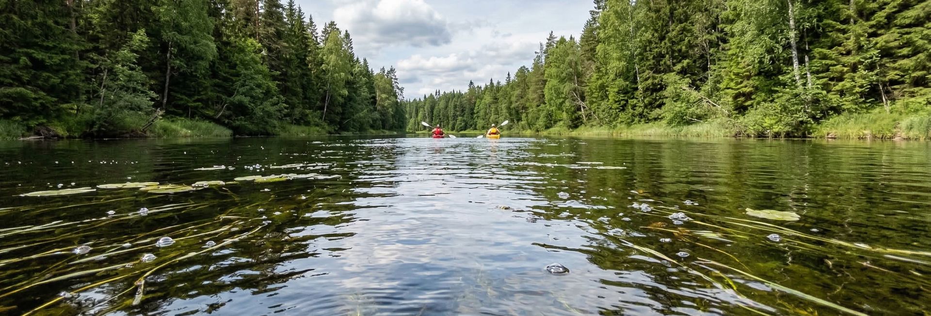
Situated along Chester River in Maryland, Shadding Reach provides convenient river access for kayakers, canoeists, and other paddlers.
Kayakers will find the waters here well-suited to touring and exploration. The waters here are approachable for canoes, making it a good option for family outings.
You can expect mild current water when paddling here. The recommended season runs March through November. Facilities include parking and dock.
Paddling Tips
- •Check local conditions before heading out.
- •Wear a properly fitting PFD at all times while on the water.
- •Let someone know your planned route and expected return time.
Frequently Asked Questions
- How do I access Shadding Reach?
- Shadding Reach is a public bank access in Maryland. The entrance fee is Fee required. Hours: 5 am to 10 pm.
- What activities are available at Shadding Reach?
- Shadding Reach supports kayaking, canoeing. The difficulty level is rated beginner, making it great for all skill levels.
- What amenities are at Shadding Reach?
- On-site amenities include parking, dock. Parking: 3 trailer, 3 car spaces.
- When is the best time to visit Shadding Reach?
- The best time to paddle at Shadding Reach is during spring and summer and fall. March through November
- What are the water conditions at Shadding Reach?
- Water conditions at Shadding Reach include mild current.
- Is Shadding Reach good for beginners?
- Yes, Shadding Reach is rated beginner difficulty, making it an excellent choice for first-time paddlers and families.
Location data: USGS ScienceBase · Water conditions: USGS NWIS · Weather: National Weather Service · Coordinates: 39.2514, -75.8815
Quick Facts
- State
- Maryland
- Region
- Northeast
- Coordinates
- 39.2514, -75.8815
Best Paddling in Maryland
Read our complete guide →
Paddler Reviews
Write a Review
Trip Reports
Paddle Routes from Here
No paddle routes from this location yet.
Be the first to create one!
More Paddling on Chester River
6 other launches on this water body
Millington Waterfront Park
Maryland · 2.3 mi

Crumpton Landing
Maryland · 2.8 mi
Deep Landing
Maryland · 4.3 mi
Buckingham Wharf
Maryland · 7.2 mi
Wilmer Park
Maryland · 10.4 mi
Quaker Neck
Maryland · 14.3 mi
Nearby Paddling
Unicorn Millpond Lake
Maryland · 1.2 mi
Millington Waterfront Park
Maryland · 2.3 mi
Crumpton Landing
Maryland · 2.8 mi
Deep Landing
Maryland · 4.3 mi
Buckingham Wharf
Maryland · 7.2 mi
Penningtons Point
Maryland · 7.7 mi