Activity
Conditions
Amenities
Glen Cove
Glen Cove is a public boat ramp on Susquehanna River Maryland. This beginner-level spot offers kayaking, canoeing. Amenities include boat ramp, parking, restrooms. Best visited in spring and summer and fall.
At a Glance
Water Body
River
Launch Type
Boat Ramp
Difficulty
Beginner
Fee
Fee required
Hours
24 Hours
Activities
Kayaking, Canoeing
Parking
12 trailer, 4 car spaces
About This Location
Public launch on Susquehanna River in Maryland. Beginner-friendly river paddling.
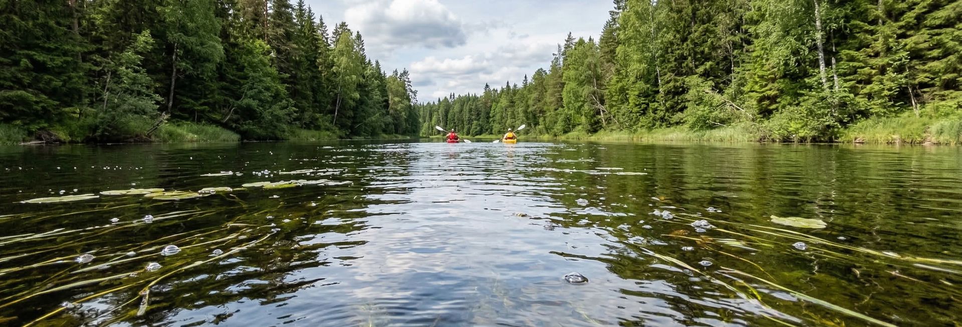
Situated along Susquehanna River in Maryland, Glen Cove provides convenient river access for kayakers, canoeists, and other paddlers.
Kayakers will find the waters here well-suited to touring and exploration. The waters here are approachable for canoes, making it a good option for family outings.
Water conditions are generally mild current. March through November is the recommended window for paddling here. Facilities include boat ramp and parking and restrooms and dock.
Paddling Tips
- •Check local conditions before heading out.
- •Wear a properly fitting PFD at all times while on the water.
- •Let someone know your planned route and expected return time.
Frequently Asked Questions
- How do I access Glen Cove?
- Glen Cove is a public boat ramp in Maryland. The entrance fee is Fee required. Hours: 24 Hours.
- What activities are available at Glen Cove?
- Glen Cove supports kayaking, canoeing. The difficulty level is rated beginner, making it great for all skill levels.
- What amenities are at Glen Cove?
- On-site amenities include boat ramp, parking, restrooms, dock. Parking: 12 trailer, 4 car spaces.
- When is the best time to visit Glen Cove?
- The best time to paddle at Glen Cove is during spring and summer and fall. March through November
- What are the water conditions at Glen Cove?
- Water conditions at Glen Cove include mild current.
- Is Glen Cove good for beginners?
- Yes, Glen Cove is rated beginner difficulty, making it an excellent choice for first-time paddlers and families.
Location data: USGS ScienceBase · Water conditions: USGS NWIS · Weather: National Weather Service · Coordinates: 39.6715, -76.2028
Quick Facts
- State
- Maryland
- Region
- Northeast
- Coordinates
- 39.6715, -76.2028
Best Paddling in Maryland
Read our complete guide →
Paddler Reviews
Write a Review
Trip Reports
Paddle Routes from Here
No paddle routes from this location yet.
Be the first to create one!
More Paddling on Susquehanna River
6 other launches on this water body
Fisherman's Park/Shuresville Landing
Maryland · 2.2 mi
Line Bridge Landing
Maryland · 3.7 mi

Susquehanna State Park
Maryland · 6.5 mi
Port Deposit
Maryland · 7.0 mi

Dorsey Park
Pennsylvania · 7.6 mi
Cold Cabin Park
Pennsylvania · 8.7 mi
Nearby Paddling
Conowingo Creek Landing
Maryland · 0.9 mi
Fisherman's Park/Shuresville Landing
Maryland · 2.2 mi
Broad Creek Public Landing boat ramp
Maryland · 2.6 mi
Line Bridge Landing
Maryland · 3.7 mi
Susquehanna State Park
Maryland · 6.5 mi
Port Deposit
Maryland · 7.0 mi